GNSS Buoy Comparison
Before the job, the buoys get checked against each other and against a reference system. It is the independent reference system that is the true test.
12/22/20232 min read
Understanding GNSS Buoy Calibration: Beyond Field Checks
For those utilizing GNSS Buoys in marine applications, ensuring the accuracy of these devices is crucial. At Freooceans, we recognize that a standard procedure before deployment involves checking buoys against each other and a reference system. However, it's vital to understand what this process entails and what it does not.
Before Starting: One of the main reasons for completing the checks, is to ensure that you have measured the buoy draft correctly and that the water level to Antenna Phase Centre (APC) is correctly applied. On all Sharkbuoys, a draft mark that is 700mm from the APC is marked on the buoy hull. On newer Sharkbuoys, draft marks (like those on a ships bow and stern) are inbuilt into the hull of the buoy. It can be easiest to mark the water level on the buoy at a boat ramp, shallow beach or by using a tender. Of course it is always a good idea to double check the draft mark to Antenna with a total station or even a tape measure.
Field Checks: A Misinterpreted Step A field comparison check might lead some to believe their equipment is "calibrated" when it only means that two buoys are giving the same reading. This is not calibration; it's a basic field check. It might alert you to a discrepancy, but it can't identify which device is accurate. When both devices have skewed calibration by the same degree and in the same direction, they might not reveal any issues or indicate a trend toward an "out of calibration" condition.
For instance, if both GNSS buoys have had their draft measured incorrectly by an equal measure, they may appear to be functioning correctly, but in reality, their results are erroneous.
Common Mistakes It's easy to attach the wrong shackle or buoy counter weight before deployment. especially if there are different crews or teams on the job. Clearly mark the counter weight and shackles used during the checks. Make sure they dont get swapped on the job as even a few KGs difference in shackles can effect the draft of the buoy.
The Calibration Gold Standard Effective calibration requires a standard that is demonstrably more precise than the instruments being tested. While it's not always feasible to calibrate against a permanent fixture, Freooceans advises comparing Sharkbuoys to a third source for GNSS water level measurements. This could typically be the survey vessel, but for even greater accuracy, one could utilize:
A tide gauge tied to the geoid.
A total station.
An RTK Rover linked to a survey control mark.
Each of these methods provides a different layer of verification and accuracy, ensuring that the buoys are not just compared but truly calibrated.
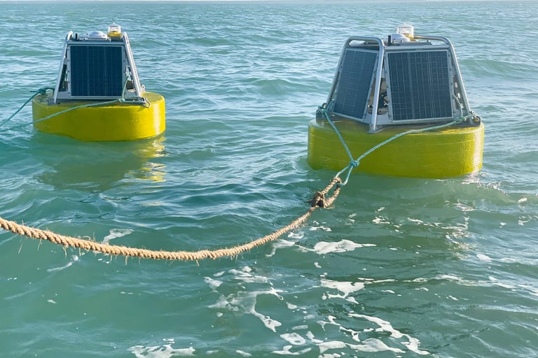
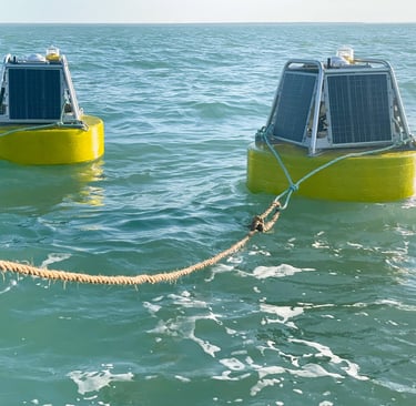
Practical Demonstration Consider the accompanying image, which shows two Sharkbuoys moored behind a survey ship at anchor. These buoys are actively logging data, which will be rigorously compared to the ship's high-precision GNSS readings, adjusted for the waterline. This comparison is more than a field check; it's a step toward true calibration, ensuring that the data they collect and relay is not just consistent but accurate.
Takeaway Discerning between a simple field check and thorough calibration is critical for the integrity of marine data collection. By applying a more stringent standard of calibration, you can deliver reliable data for your marine projects, ensuring that decisions are made on the basis of accurately calibrated equipment