FREOOCEAN Sharkbuoy MkIII GNSS Buoy procured by MMA OFFSHORE
Discover how MMA Offshore trialled the use of Freoocean's Sharkbuoy MkIII in a hydrographic survey in Western Australia. Learn about the challenges and successes in this high-tech venture, in the Kimberley Marine Park.
1/8/20242 min read
Moreover, the SI 1042 survey was conducted with a deep respect for cultural sensitivities, particularly above Alarm Shoal (Oorroondoorroon), avoiding charting in areas shallower than 10 metres. Nonetheless, the surrounding waters were meticulously mapped to ensure safe navigation, addressing the lack of recent survey data and updating information that had not been thoroughly revised since the surveys by NATMAP and HMS Fantome in the mid-1970s and early 1900s, respectively.
The successful completion of SI 1042 by MMA Offshore will not only updates critical navigation charts but also reinforces marine safety and environmental conservation in this ecologically and historically significant part of Australia. The utilisation of the Sharkbuoy MkIII has highlighted the importance of deploying reliable, high-quality survey equipment to facilitate such important hydrographic work.
More information regarding this survey and the HIPP program can be found at the AHO site: https://storymaps.arcgis.com/stories/31f0e465d31549d69aeddf34219ef983
Freooceans’ latest generation Sharkbuoy MkIII has been procured by leading global marine and subsea services provider, MMA Offshore (MMA), following a successful trial conducted during a HydroScheme Industry Partnership Program (HIPP) hydrographic survey in Western Australia.
MMA has recently wrapped up the fieldwork for the HIPP hydrographic survey project SI 1042, mapping the waters from Lord Mayor Shoal to Pitt Shoals within the Kimberley Region. This ambitious operation, active from September 2023 to May 2024, will provide a critical update to maritime charts covering an essential inshore passage from Broome through the Lacepede Channel and towards Cape Leveque and King Sound. This undertaking is adding to the collective efforts of past HIPP surveys, expanding upon the groundwork laid by SI 1010, SI 1014, and the ongoing SI 1025 initiatives.
Surveying the expansive 212 square nautical miles of SI 1042, the MMA team navigated a region rich with marine biodiversity, ensconced within the Kimberley Marine Park and the Bardi Jawi Gaarra Marine Park. These waters, teeming with whales, dolphins, dugongs, and a host of endangered birdlife, also presented a challenging mix of shallow and deep areas, peppered with numerous shoals, demanding accuracy and environmental mindfulness.
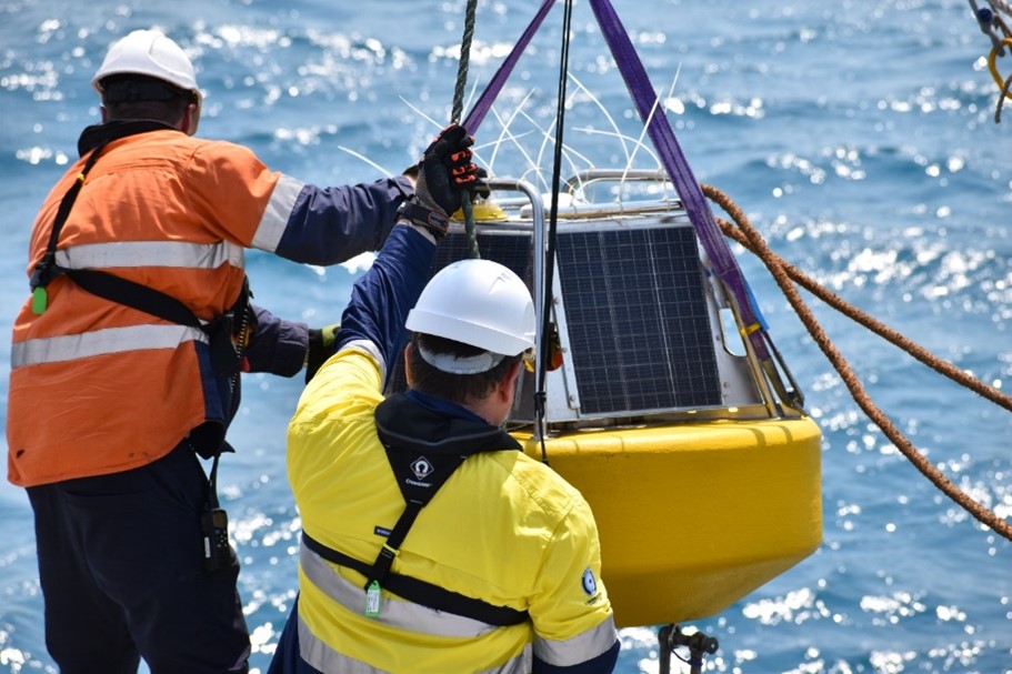
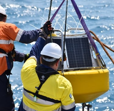
To ensure the precision of the depth data, tide gauges were strategically placed throughout the survey area – a standard practice in modern hydrography to account for tidal influences. The latest iteration, the Sharkbuoy MkIII, was deployed in several key locations, playing an essential role in accurately determining the tidal datum. This data was crucial for connecting the tidal datum to the ellipsoid, which is a cornerstone in developing the AUSHYDROID, the Australian height datum used for mapping and surveying.
MMA Survey Party Chief, Ahmed Said, praised the technology: “The optimal size, reliability, and ease of working with the Sharkbuoy surpass many others we’ve used. Its impressive design, coupled with reliable data, proves to be a significant advantage in our operations during the HIPP program.”