This is a Hydroid Model, Part 1
A hydrographers boiled down explanation of what a Hydroid is and how it is useful. Part1
4/16/20245 min read
What is the Hydroid
Outside of hydrography, hydroids are a group of carnivorous mollusks, including species like the delicate Obelia, known as sea fur, and the symbiotic Hydractinia, referred to as snail fur. These creatures contribute to reef building and some species have venomous tentacles.
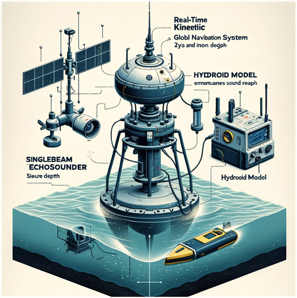
Chat GPT says that a Hydroid is in the image above, although we cannot see it.
To surveyors in Australia, the word "Hydroid" is a term adopted to when we talk about the spatial model used to adjust from the height that your GPS spits out, to a height relative to Chart Datum (LAT). It's a modification of the term "Geoid," an internationally accepted term for different correction models that convert between MSL and GPS (lets now refer to as GNSS in non-American terminology).
Why have Hydroids?
The hydroid can allow your ships GNSS to give you accurate heights relative to LAT. There are several reasons why this is useful including allowing the captain to be sure he has enough elevation over shallow rocks when navigating etc., but we are here to talk about hydrography. If your GNSS can give you accurate LAT heights, then with limited equipment, you can operate with your echosounder to measure accurate LAT depths. This may not sound like much, but is actually a very big deal saving time, effort, and potential for mistakes.
What came before the Hydroid?
In days gone by, Prior to accurate GNSS, tide gauges would be deployed during each survey. These take a great deal of effort to calibrate, install and keep operating. They are prone to being lost in storms and can be dislodged by current and waves. Furthermore, correction of raw gauge data to a reliable datum requires complex processing and results can vary depending on the approach selected.
Other issues with the tide gauge method include : Squat- the boat will change its elevation depending on speed through water, water depth and other factors. Squat not measured by the tide gauge so how do you correct data for it? Draft: as the boat burns fuel or unloads cargo the elevation of the ship’s hull (and sonar) changes. Surveyors must carefully adjust for this.
There is a lot of skill required to acquire reliable, good quality bathymetry data corrected with tides. There are many opportunities for introducing error. Tide gauging a lot of effort and only possible by well trained, experienced surveyors.
Furthermore, if an area is to be resurveyed, an entire network of tide gauges must be re-calibrated, redeployed, avoid being disturbed in storms, recovered to shore, data downloaded, QC’d, processed…. And on an on.
So How can our GNSS help?
With the advent of accurate vertical positioning with GNSS, (such as RTK, PPK and PPP) “ellipsoidal referenced surveying” has been developed. The surveyor can measure depths extremely accurately and without to much know how-effort, repeatable results can be achieved.
The obvious problem with this method alone, is that the heights measured here are not immediately relative to a useful datum like LAT. The GNSS datum is the ellipsoid which is a mathematical model of the Earth's shape. The ellipsoid makes a very basic assumption that the earth surface is near sphere like shape. In Australia, this squashed sphere can be up to 50m different from the actual sea level! Alone, GNSS heights are not much use for safety of navigation.
Useless then? Wrong. As the ellipsoid is such a simple representation of our globe, the results are very repeatable! In each location the surveyor can apply a value to shift from the GNSS ellipsoid datum to LAT to get useful tide level out of the GNSS unit.bWe call this exceedingly useful value a Separation Value, and with it we can avoid the costly deployment of numerous tide gauges every time we complete a survey.
What is stopping us getting the Hydroid online today?
Step 1, The first piece of the puzzle brings us back to the tide gauge: There is no getting around it: tidal data needs to be logged at any and every location to create a single hydroid Sep. Value. There is no getting away from the tide gauge. We need a minimum of 35 days of good tide data at a location to get a good understanding of the datums. We call this process, establishing the datum.
(FYI, 29.5 days is a complete Lunar phase cycle – this includes 2 neaps and 2 spring tides. 35 days allows a bit either side and is considered the minimum for a reliable tide logging session to be used for establishing the datum. Note: in areas where there are crazy environmental or seasonal factors, 35 days may not be enough!)
We are unable to avoid logging tides. If you are the first to survey in an area, you will likely have to observe the tides. The great new is that once the tide record has been observed, we shouldn’t have to repeat this process any time soon or for later surveys.
Step 2, observe the Seperation Value between the LAT datum and the ellipsoid. This is the second part of the puzzle. To observe the Sep. Value, we must deploy an accurate GNSS to measure the water level in parallel to the tide gauge logging. In other words, whilst the tide gauge is in getting >35 days of good water levels relative to LAT, we must have another device logging the water level relative to the GNSS Ellipsoidal datum. The most common way to measure the GNSS tides is with a buoy kitted out with a GNSS system. Other methods include using a vessel with accurate GNSS anchored up or a surveyor on a beach with some land survey gear checking the water level frequently (take it from me, this is a tedious method, with or without sandflies).
Are we there yet?
Over the years tidal data has been logged far and wide along our coastline – surely, we are nearly there?
To put it bluntly NO. Until recently there has been a lack of a coordinated approach to acquiring tide data – the volume of data wasted and stored in private archives, or on aging hard disk drives, I would estimate, would be staggering.
Furthermore, there has been a lack of coordination to curate this collection of very useful tidal data. There are no widely adopted standards for the logging of tide data, QC and processing methods are not standardised and procedures for doing so are not shared within the community. There is no repository for storing data that is widely known or advertised.
Crucially, the critical component of acquiring the GNSS buoy data, in most cases has not even been considered by our surveyors? Why log this data if there is not a way to feed it back into the system, no clear way to submit to the national Hydroid project and no clear goal on the horizon?
Fortunately, there are signs of changes. The Australian Hydrographic Office is chairing a working group to propose the way forward (although no roadmap or goals have been proposed). More information can be found here: https://www.icsm.gov.au/what-we-do/aushydroid.
Possibly the biggest development has been with the HIPP program. GNSS Tide logging is included in the national charting Hydroscheme and they have now developed the first standards for tide gauge logging and GNSS buoy operation. A breakthrough 3-year GNSS buoy project was funded in Torres Strait and There is talk of more investment in hydroid development down the track. We feel that industry could be mobilised to help this effort be realised in much less time if we work together.
A huge amount of effort, wasted time and resources could be saved by a collaborative approach to data sharing and standardisation of Tide and GNSS Tide aquisition processing and storage. Furthermore the cost of getting a hydrosurvey completed would be greatly reduced having knock on effects to developments within our blue economy. Thankfully we are starting to move this forward!
Part 2 of this discussion is in the works and will be published at a later date and we intend to discuss ideas for moving the Aushydroid project forward and we look at the success of other similar hydroid projects around the world. Be part of the conversation and comment on this post!